My Miniblog
WILDCAT HIKE 2015
We slept in the cars last night, and then went to McDonald’s for breakfast and coffee. Rain was predicted by this little grandiose know-it –all who worked at McDonald’s, which intimidated me tremendously. It started to rain on the way to Pinkham Notch, which added to my anxiety. The tension was broken when Scooter saw a bull moose getting ready to cross the road on the way. He had just started to grow his new antlers, but he was still intimidating. We were in the car, but I wouldn’t want to hit the big bull.
We got to Pinkham Notch where most of the folks there were hiking up the trails to the Presidential Range with snow ski’s, strapped to their packs. I assumed they would hike up and ski for the day then hike back down or stay up high for the week.
After a short time, we decided to abort the hike due to the rain and headed back to New York. A half hour later, the rain quit and the sun came out. I was as down as I get because we quit. I was afraid of the mountain, but more afraid that if I quit now I would never get the courage to climb it again. I believe once you quit once it gets easier to find an excuse the next time. I pulled over to talk it over with Scooter and decided to return. We turned around to face my fear.
Scooter wasn’t pleased with my indecision, but went along as supportive as she could be. Once again, we left my car at Gorham on route 2 and took hers to Pinkham Notch. This time there was no turning back.
We hiked about a mile along the base of the mountain to Lost Pond before we started our assault on Wildcat in silence. The two miles up Wildcat’s peak E face took most of the day. It was a grueling hand over hand climb most of the time with zero let up to relax. Once we committed to ascend Wildcat there was no turning back, because I don’t think we had the skill to have descended the mountain.
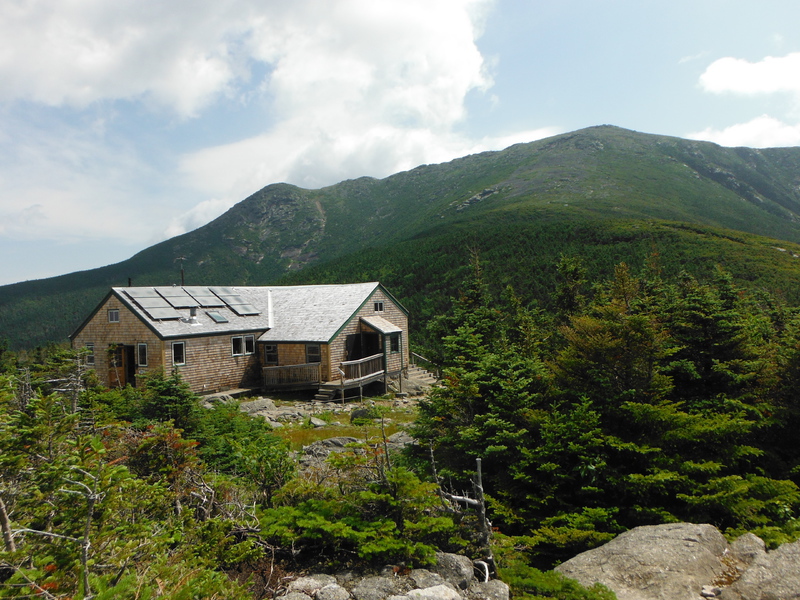
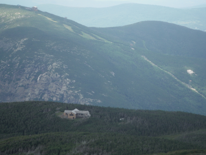
I thought the mountain would go on forever, but eventually we reached the top of Wildcat’s peak D where a silent ski gondola stood waiting for next year’s snows. We took a short break to celebrate our accomplishment, but it was late afternoon and we only hiked 3 miles. Our planed destination was another 3 miles to Carter Notch where there was a Appalachian Mountain Club Hut where we could rent a bunk for $35 for the night.
We trudged on as fast as we could, but the day was ending fast and the distant thunder predicted a storm was coming soon. We were still over two miles from the hut when it was obvious we weren’t going to make it. We stopped and prayed for help and soon came upon a thick mossy place off trail, small, but big enough for our two little tents where we could spend the night.
We no more than got set up and in out tents when the rain started. The rain started softly at first, but soon got into a violent lightening storm with frightening lightning that rocked Wildcat Mountain. We were way up higher on the mountain than I ever wanted to camp in a small tent with aluminum poles, but we turned our fate over to our Creator and left the outcome up to Him.
I fell asleep during the worst part of the storm, which kind of pissed Scooter off, but when I awoke it was still thunder and lightning out.
Eventually the storm settled into a steady rain on the tents, which sang me back to sleep until just before daylight.
We ate breakfast, Scooter ate oatmeal, and I had of tuna and noodles, which we washed down with strong bad trail coffee. We had to pack up wet tents and gear, but we were thankful to be back on the trail. Alcoholics Anonymous has a slogan that goes, this too shall pass. We hoped the worst was over.
We hiked along Wildcat ridge over peak C and then A. The trail then dropped from peak A very steeply one mile into Carter Notch. We stopped for a break at Carter Lake, which is a small pristine lake in Carter Notch. We could see trout in the crystal, clear water of the wilderness lake. The sun was out in full force by then, but time and the fear of ice-cold water kept me from skinny-dipping. I would so much like to cast a dry fly on Carter Lake’s water some day in hopes of a trout lunch.
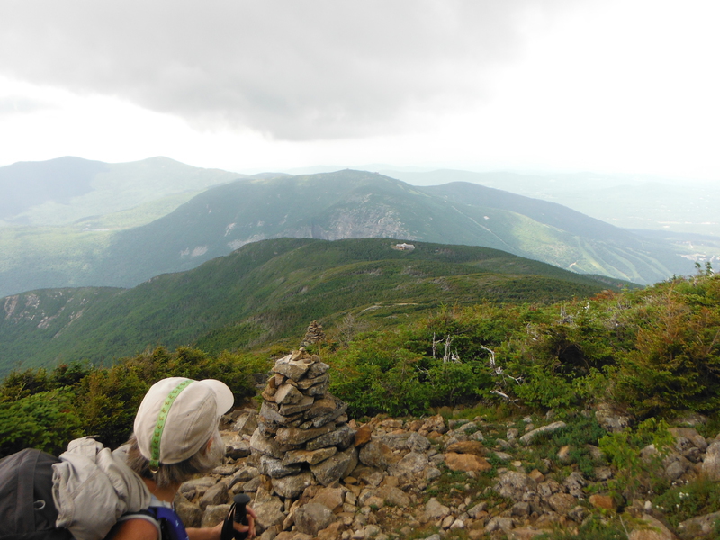
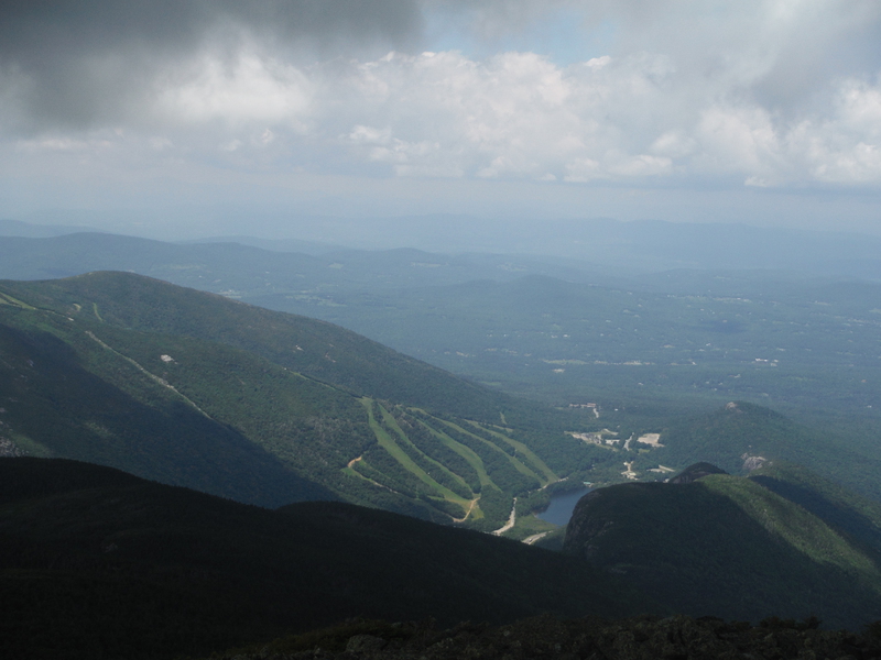
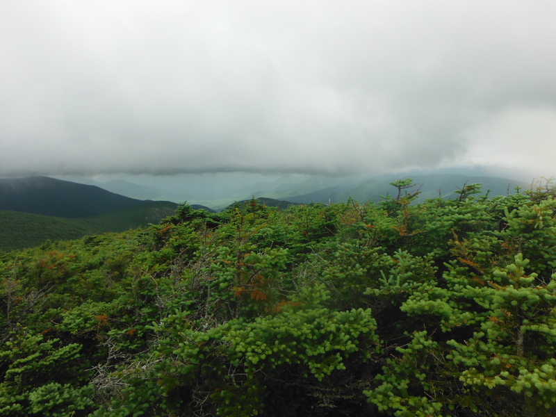
We then ascended just as steeply over a mile to the summit of Carter Dome at 4832 feet high. A magnificent view of the Presidential Mountain Range rewarded us for our effort. We tried to identify all the mountains. Washington was the easiest because it’s the largest and it’s the only one with smoke stacks on the top. We could also identify Monroe, Jefferson, Adams, and Madison, I think, but Mt Clay is in there somewhere, so I could be wrong. The view was worth the whole trip.
We encountered deep snow on the trail on the north side of Carters Dome. We could see snow on the Presidential Mountains and a thru-hiker warned us that there was snow on the trail on Carter, so it was no big surprise. We took it in stride and hiked on it for about half a mile, we still came across some patches, but it was no big deal. What was a big deal was the heavy snows of winter broke down trees all along the trail that blocked the trail. We had to continually climb over or go around these trail blockers, which slowed our progress and was also physically challenging with a heavy pack.
We took a late lunch break, but once again moved on to make it to our destination of Imp Campsite, where we wanted to stay. The campsite was 6 more miles away, so realistically I didn’t think we could make it. We prayed and believed God would provide a place to spend the night. Jesus once told his disciples to just go and not worry about where to stay. I wish I could not worry, but I did believe we would be okay. Scooter always says, God’s provision and she hasn’t been wrong yet.
We trudged on and I wasn’t sure how far we had to go late in the day. The first landmark I could identify was Zeta Pass, which was almost 4.5 miles from our campsite. I knew we wouldn’t make it that day, but we would go as far as we could.
Late in the day, when we approached Middle Carter Mountain the sky clouded up and we could see the storm coming over the distant Presidential Mountains. Black clouds covered Washington’s summit. We came upon a flat mossy place, but we elected to pass it by hoping the storm would pass by us. I had an eerie feeling I was pushing my luck as we hiked on.
The storm didn’t pass us by and when it hit there was no place to take shelter, so we put our ponchos on over our packs and trudged on. Scooter seemed unconcerned and said, “God will provide.”
It was getting late and we were soaking wet. We were somewhere between Middle Carter and North Carter Mountains and very high up when we came across a moss covered flat spot at the bottom of a sharp incline where we would be safe for the night.
We set up in wet tents, crawled into wet sleeping bags, and ate a cold supper of a bagel with peanut butter. Our synthetic sleeping bags warmed us up even though they were wet. We went to sleep with heavy rain and strong wind, but the thunder and lightning had passed.
We awoke to a calm clear morning where the day promised to be clear and sunny, which elevated our spirits. We however still crawled out of sopping wet sleeping bags and packed up wet heavy tents. We were on trail by 6:00 after bad trail coffee.
The sun rose and dried up all the rain by the time we passed the Imp Shelter/Campsite. Shortly after we passed Imp we decided to set up our tents and wet gear on a large granite rock to dry out. It was about 10:00, so we cooked lunch while we waited, which took less than an hour. We packed up dry light gear and were off. I was surprised at how much the break to get dried out improved our moods.
We trudged on making better time as the harsh terrain gave way to gentler slopes with a few steep ascents and descents thrown in to remind us that we were still in the White Mountain National Park.
I came down with an annoying blister that I had to treat, which slowed us down. We had one last mountain to climb named Mariah, like the wind. It was a long, but gentle climb to a spectacular view of what I believed were the White Mountains of New Hampshire on one side and the Maine landscape on the other side. We descended Mariah steeply then the landscape changed from fir trees to hardwoods and softer footfall.
We hustled down the trail along the Rattle River anticipating getting off the trail and a pizza that night, but it wasn’t to be. About seven o’clock I could not physically go on, so we stopped along the river and set up camp in a dry tent and sleeping bag. The river sang us to sleep before it even got dark. I thought once again of God’s provision.
We were up at the first light of dawn and on the trail with only crackers for breakfast. Ironically, the Rattle River Shelter was less than a half mile away from where we stopped. I told Scooter we had a much better place to stay anyway and she agreed. We quickly ascended the last two miles to our friendly car awaiting our return and it was off to McDonald’s for breakfast and good brewed coffee. Thus ended another adventure for us.
2014
New Hampshire hike
Day 1
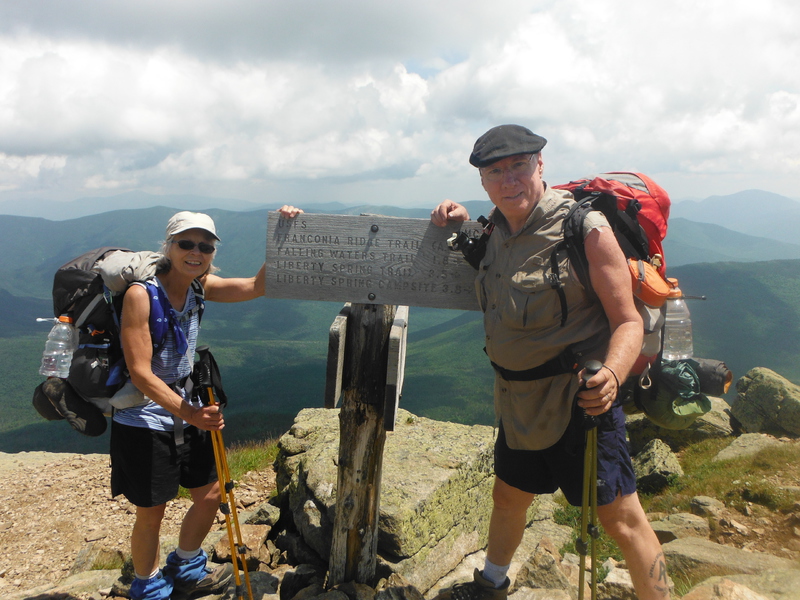
We left our camp in New York first thing in the morning the day before. We got to the White Mountain National Park long enough before dark to scout out our plan for the first leg of our hike starting first thing in the morning the next day. We spent the night at Crawford Notch, left my car there, and took Scooters car to the hiker parking four miles below the Franconia Ridge in the Franconia Notch State Park.
We terminated our last hike in the Whites on the summit of Mount Lafayette two years before, which is where we
planned to resume. The trouble is we have a four-mile hike up a ridge called Agony Ridge to the summit of Lafayette. The
We packed up enough supplies from our hiker bin at the car for a three-day hike to our other car parked at Crawford Notch. We left with a little apprehension since we haven't been on a hike this strenuous for a few years. I believe the White Mountains are the most difficult section of the entire Appalachian Trail.
The trail we chose is called the Old Bridal Path, however having descending it previously two years ago , I find it
hard to believe a horse could have ever climbed or descended it over Agony Ridge. We set off at a rather brisk
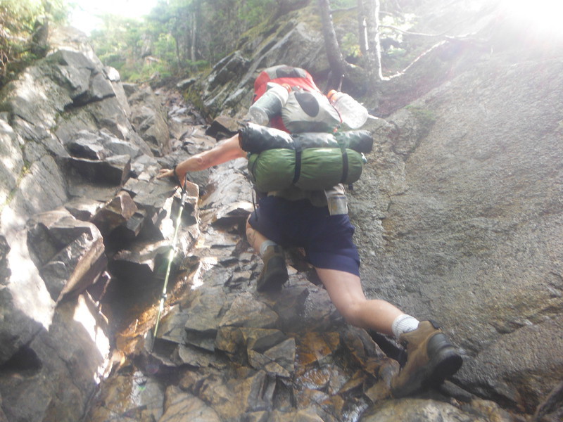
Hand over hand.
Scooter had a hard time on the tough climbs due to being much smaller than I am, but I stayed patient and stopped often. Some of the climbs were almost vertical, I tried to take several pictures, but the pictures didn't show the depth or the steepness.
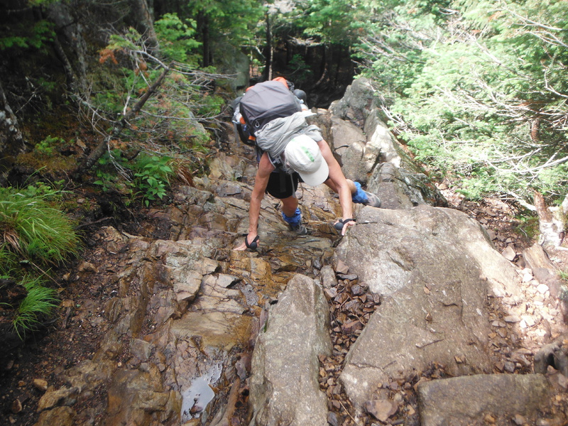
Scooter climbing
Often we would come to a cliff edge on the ridge and get an excellent view of our goal, which was the summit of Mount Lafayette.
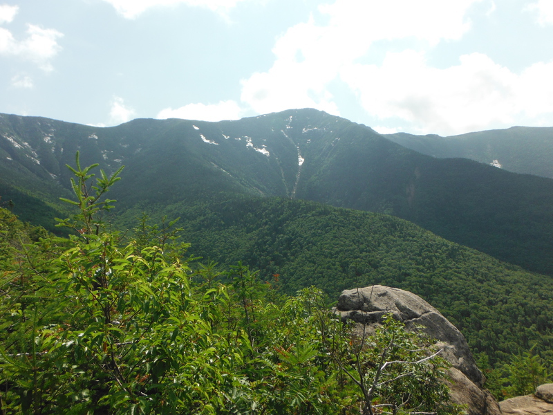
Mount Lafayette
The map said it was 2.9-miles to Greenleaf Hut. We hiked and climbed over three hours before the mountain gave way
to some
Looking down at Greenleaf Hut & the valley below.
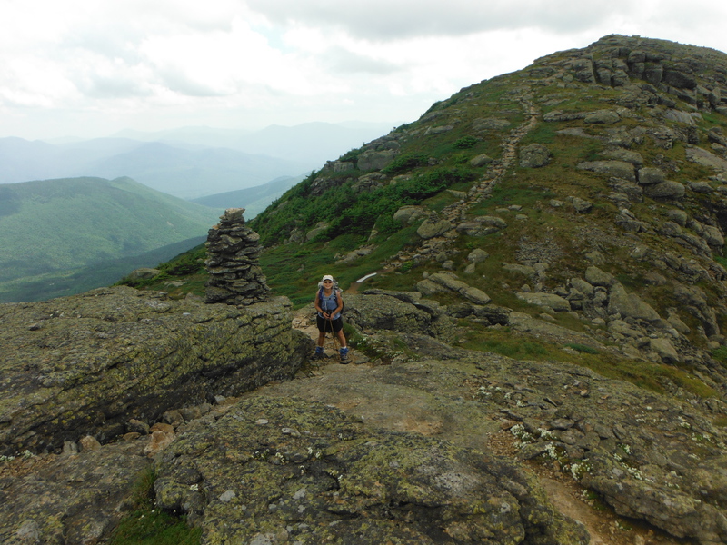
Once we were above treeline, we could no longer see the trail through the vegetation for obvious reasons (no vegetation), so cairns marked the trail. Cairns are a heap of rocks piled up by volunteers to mark the trail. We could see the trail clear to the summit. We also could see several hikers above us both ascending and descending.
Cairn
Granite boulders ranging in size from a
Note the scars on the mountain below are ski slopes.
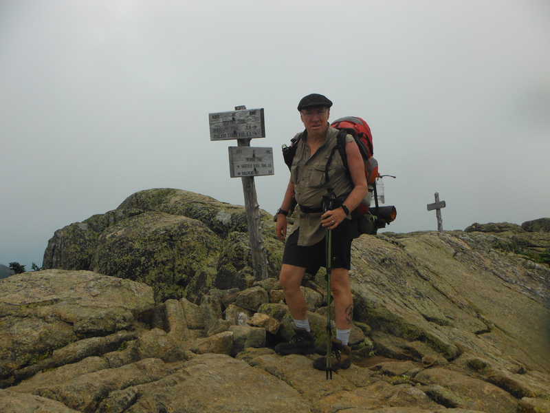
The Summit of Lafayette
The clouds started to move in, but weren’t threatening yet. However, we moved out quickly down the Appalachian Trail towards the safety of below treeline before the pending storm hit.
Scooter on the Franconia Ridge.
We were safe below treeline long before the storm hit.
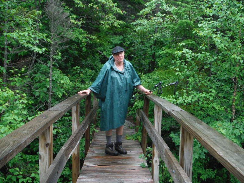
In the rain, but safely below treeline.
The day dragged out and we were losing energy fast. I could now see that I underestimated how quickly we could make it to the Guyot Shelter, which was our original goal for the day. We set a new destination for the Garfield Ridge Campsite, which was four miles from the summit of Lafayette. The time was about four o'clock and we still had about four hours of good daylight. We stopped alongside the trail, cooked some noodles, and ate a lot of chocolate for a good rest and renew our energy.
The rain stopped and we moved on at a slow pace after an hour. We met four girls thru-hiking together that were headed for the same campsite we were. They hiked much faster than we were capable of, so I worried if we would have a place to stay that night. I reassured Scooter that I'm sixty-three and so far, I have found a place to sleep every night. I secretly still worried, but as it turned out, I had nothing to worry about because at about seven-thirty, well before dark, we found the campsite and set up our tents side by side on a platform. We paid the Appalachian Mountain Club Sixteen dollars to stay there for the night.
We cooked again, thanked God for the privilege of the adventure, and turned in for the night thus ending day one.
>
Day 2
We awoke to a dark, gray day. Scooter found a blister on her little toe that had already broken, so we padded it before we hiked. We made trail poor coffee, packed up all our belongings and hiked out before most of the other campers were even awake.
The first task was to hike steeply down off Mount Garfield, which aggravated Scooters blister right off the bat. The day was misty and damp, which afforded zero vistas from Garfield.
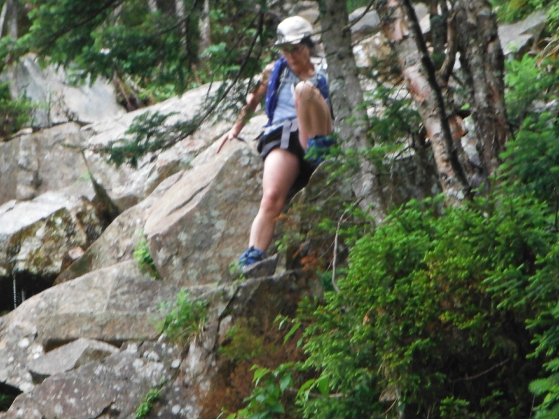
Scooter climbing steeply off Garfield.
The morning was uneventful, but it gave me a chance to connect with my Higher Power. Sometimes I just need some alone time away from the everyday hustle of the business at home. When I read about all the spiritual leaders of all time and religions one of the common threads was always that they went into the wilderness to be alone to meditate or listen to God as they understood Him. Even Christ did this often as did the others. I do it because they did it and I think it works, at least for me.
We slipped into silence as we trudged along. I don't think either one of us was going negative, but the cloud cover started to rise, so our moods soon improved and we started to chatter as if we were on our first date or something.
The clouds lifted changing the flavor of the hike.
We were hiking through the dense growth of the lower altitudes, but the trail seemed worn down to solid granite from years of hiker's boots. We ran into solid sheets of Granite going steeply up or down that hikers call, "Sierra Sidewalk."
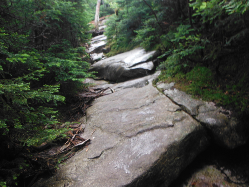
Sierra Sidewalk
The hiking on Sierra Sidewalk is easy once you learn to depend on your shoes to hold onto the surface. That's the reason I recommend a good pair of hiking boots if someone plans to hike the Appalachian Trail anywhere in the fourteen states that it snakes through, but especially in the Whites.
Early in the afternoon, a thunderstorm blew in as we approached the summit of Mount Guyot, which is pronounces Guya with the t being silent. When we started to ascend, we met a southbound hiker, who told us it was "Terrible up there with the lightening!" I heard some thunder at times, but it seemed quite far away. I questioned him a little and thought he was only an awfulizer and he was awfulizing the situation for whatever his reasons. We went right over the summit as the storm subsided enough to give a feeling of security as we reached the top.
The top of Guyot that day
Scooters blisters started to escalate in the early afternoon, which slowed us down considerably. We trudged on in the on and off rain. Late in the day, it became obvious that we weren’t going to be able to reach our goal of Ethan Pond Campsite, which was still about 7 miles away, so I started to scout out a stealth campsite.
Stealth camping is what hikers call finding a place in the woods to set up a tent for the night. It took almost an hour to find a place suitable to set up both of our tents for the night. New Hampshire doesn't allow fires when stealth camping for a minim disturbance to the environment. This is called low impact camping.
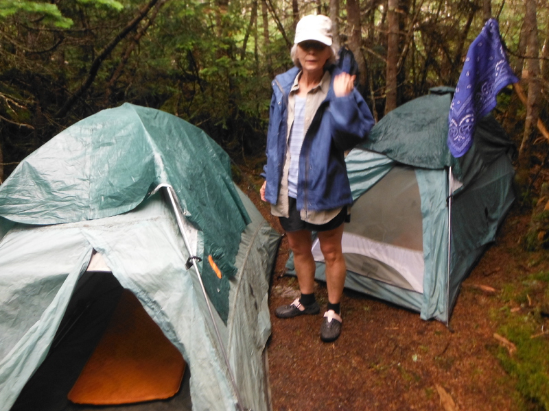
Our stealth campsite.
The rain subsided until we set up camp. We each cooked our supper on our little pocket rocket stoves and ate before the rain started with a vengeance.
We took shelter in our little tents long before dark. We tried to hold a conversation through the tent walls, but the rain stifled that, so I went to sleep. I assume Scooter did the same, thus ending Day 2.
2014 Vermont Hike
We are starting to stage for the upcoming hike. Target date to launch is May 10. We have been training or months, but just got serious lately.
5/11/2014
7:00 am
We left home yesterday to drive to our fishing camp in upstate New York. Spent the night here and awoke to a pleasant, but sunshiny morning. I’m having trouble with the Verizon internet provider. So I couldn’t post on FB. I will stop at McDonalds and hopefully post on the way to Vermont.
3:00pm
We stopped in Manchester Center to buy bug screens and then to McDonalds, so I could put some stuff on my web page and Facebook. Then we drove to the Trail
****
We are on the trail at last. We had an excellent trip over from NY and other than a stiff back we are excited to be on the trail. I will post whenever I can.
Sunday night and we hiked into Bromley Shelter, which is about a mile below the summit of Bromley.
We planned a short hike on the first day in since my pack weight exceeded 45-pounds. My back stiffened up after the most part of two days in the car, so I thought I would start out slow. I was glad I did since I hurt my low left back on the hike up Bromley. I think I just needed something to worry about since I’m so good at that.
The day was cool, sunny, and windy, which is about perfect for hiking. I did get a little overheated at first, but cooled off after the initial surge up the mountain. We carried no water since we knew there would be plenty. Water is heavy and I never carry it if I don’t have to. We stopped twice to filter some on the way
We arrived at about 5 o’clock and set our tents on a flat platform that was provided about 50-yards from the shelter. I prefer to sleep in my tent as opposed to the shelters. The shelters are open and have a lot of spiders and mice. People are known to come in at any hour and it seems that there is always someone who has a black belt in the fine art of snoring. Once, someone almost set me on fire trying to light his wisper-lite stove at midnight. I probably shouldn’t have shot him, just kidding. You get the picture.
We rested then went to the spring and each filtered two, two-liter bottles of water for the night. I used some water to cook Buffalo-chicken rice. I also ate a can of sardines to give me some protein and omega3 acids. The other bottle I mixed in a scoop of protein powder, a scoop of instant coffee, and four packets of sugar to start me up in the morning. Scooter cooked mac-n-cheese with dehydrated green beans. We ate and went back to our tents. It looks like we have the shelter area all to ourselves tonight. My low back pain settled down some, but I’ll take some night-time ibuprofen before I crawl in the bag for the night.
I caught up on my journal and talked to Scooter through the tent walls until she fell silent.
Day 2
Some hikers came into the shelter late and apparently drank for quite a while. I woke up at 2:00am to them shouting. The moon was so bright that I thought it was morning, so I ate my breakfast of M&Ms. I’m glad I didn’t drink the coffee or I would have never went back to sleep after I discovered it was only 2:00am.
We slept until daylight and drank the coffee. Scooter never woke up in the night, so I didn’t tell her about our neighbors until later.
We were on the trail by 7:30 and hiked one mile up to the summit of Bromley Mountain. My low back gave me some problems, but it wouldn’t be hiking if I didn’t have some pain. Bromley is a ski resort and the tramway and ski lifts at the top were abandoned for the summer.
I tried to dream the pain away by trying to connect with God as I understand him. I was told by my second sponsor that prayer is when you talk to God and meditation is when you listen. I have a hard time listening when I’m in the physical world at home because there are far too many distractions. Besides I think all truly spiritual mortals spent a lot of time alone listening to God as they understood him; John the Baptist for example. Native Americans spend a lot of time listening to the Creator and they go on vision quests and sweat lodges to clear their mind of the physical world so they can listen.
I tried in the morning, but I couldn’t summon the Spirit. I don’t think I ever could or I would do it more. I just have to make myself available and the Spirit will talk when the Spirit is ready. In the meantime I love being in the church that God himself built. Besides I think I was too focused on my own pain to be ready to listen.
We descended Bromley and filtered more water in the gap between Bromley and Styles Peak. A thru-hiker named Shaggy Moe stopped and we had a long talk. He was contemplating aborting his hike because of personal problems back home. Me, being the counselor I am I encouraged him to continue on to Mount Katahdin. I shared some of famous not –so-good coffee with him. He left then we immediately ascended sharply up to the summit of Styles. We stopped on the summit of Styles Peak for lunch. I ate a can of sardines that I washed down with a quart of coffee mixed with protein powder and sugar. To kill the pain, I ate two ibuprofen. That was my desert.
The afternoon was as good as it gets with clear blue sky. I love the sweet smell of pine in the high country. I call it angel’s perfume. We stayed high on a ridge between Styles Peak and Peru Peak. The ridge was overgrown with the thick, dense, pine common in high country, which blocked out the sun and insulated the winters snow and ice. As a result there was hard packed snow in the woods and ice on the trail from being packed by winter hikers. We couldn’t hike off the trail because the vegetation was so dense, so we slowed way down and hiked on the ice most of the afternoon until we descended off from Peru Peak.
The trip from the Peak was fairly easy hiking and we stopped at Peru Peak Shelter 1.3 miles down hill for the night. Once again, we set up our tents on a tent platform, but this time it was very close to the shelter. We hoped nobody stops by the shelter, but if they do a rather large creek flows within 50 feet. The sound of the water falling over the rocks will drown out the noise from the guests and sing us to sleep. We set up first then filtered water for the night and coffee in the morning. I mix up my coffee cold, then heat it up in the morning or sometimes I just drink it cold. It’s outstandingly bad coffee either way, but it is coffee.
We cooked supper. I ate Ramon noodles and Scooter had Spanish rice. Scooter gave me a peanut butter Snickers for desert. I then caught up on my blog, but couldn’t post for the second night because we have no cell tower.
Then I made some hot tea, which we shared as the sun went down. We turned in and fell silent.
Day 3
I woke up at 4:00am to rain on the tent feeling sick with a cold/flu that has been going around. I laid there depressed until daylight before I awoke Scooter. We took our gear and tents to the shelter to pack up out of the rain. Scooter ate breakfast of hot oatmeal, but I ate M &Ms and drank my cold coffee mixture. We had to change plans because the trouble with being sick or injured is you never know exactly how bad it will get. Being out here in the wilderness away from medical help was very scary for me.
We prayed then decided to head back to the car and take a zero the next day or two. This decision depressed me gravely, the macho part of me wanted to move on with the original plan, but the sane part said to play it safe, so we turned back. I think the decision was fear based, but I felt it was the safest thing to do.
The weather had turned cold rainy and gray. My mood was as gray as the day. Once I got the endorphins going and the ibuprofen kicked in I got a little rhythm going and I began to reflect on past difficulties and turns of events that didn’t go away.
I ran into Eric Rudolph in 1999 while I was section hiking in North Georgia when he was on the run. I didn’t know who he was at the time. He said he was finishing a thru-hike, so I asked him, “What advise he could give me about the trail?”
He said, “Don’t just plan it, survive it.”
I think I could apply that advice here. We donned our rain gear and set out in solemn silence. The good news was my back wasn’t hurting nearly as much as it did the last couple of days. I think we moved faster than previously, but it wasn’t fun anymore it was just a get-r-done day. I was soon wet, not from the rain, but from condensation caused by the rain gear. I couldn’t stop for long because I didn’t want to get more of a chill, so even though we were tired we couldn’t stop. My cold seemed to get worse as we trudged along. I didn’t regret my decision.
We did find a sheltered spot from the wind and rain just north of the summit of Bromley at noon. I cooked tuna and noodles to get some hot food in us. We also ate a lot of candy to give us some much needed energy. We planned to get off the trail so we didn’t have to conserve food.
The vistas we enjoyed just the day before were socked in a milky white mist. We reached the summit of Bromley. The tramway seemed like a mechanical giant enduring the weather just like we were doing. When we dropped to a lower altitude the wind died down and the temperature came up. We reached the car about 5:00 pm, but it was much darker than 5:00 the day before. I was thankful to get off the trail and now we only needed to get into some dry close, find a motel, and some hot food that wasn’t trail food. Then we both would fight over the hot shower.
Day 5 back on TRAIL
I took a zero miles day off trail the day before due to having a cold. I slept as much as I could, but we did take time to explore the trail north by car. I was glad to be back on the trail today.
We started a little after daylight hiking south from a state parking place on the Danby-Landgrove Road. Our plan was to hike south to where we left off two days ago at the Peru Peak Shelter and turn around and head north once again.
We hiked up the picturesque Big Branch River. A flood in 2010 caused by Hurricane Irene hit Vermont very hard and washed the rocks along the streams and rivers clean, leaving them white. We crossed a new impressive suspension bridge over the river, which was built since Irene. There are many new bridges in Vermont both on the trail and on the roads. Irene caused a national disaster in 2010 which closed not only the Appalachian Trail but most of Vermont for a while. We took some pictures of the bridge which I think is an amazing feat of the volunteers. It shows the dedication of the volunteers that make the Appalachian Trail in all fourteen states possible.
We met a young couple in their early twenties named Paul and Claire, who spent the night in the Big Branch Shelter. They were thru-hiking the Long Trail. The Long Trail runs parallel to the Appalachian Trail from where it starts at the southern Vermont boarder until it goes north at Killington and the Appalachian Trail turns east towards New Hampshire. The kids seemed so young and in love it was refreshing to see them out here in Mother Nature enjoying the wilderness.
We trekked on past Lost Pond Shelter where I camped with friends I had met on my thru-hike in 2006. I suppose I bored Scooter with my trip down memory-lane, but she humored me and seemed interested. We trudged on up Baker Peak, which is a knife edge type of structure where the earth heaved up millions of years ago and left the bottom of an ancient sea standing in the air. The trail followed the edge allowing us some good photo opts, but we had to be extra careful as the footing was treacherous.
We then dropped down into a swampy low-land hoping to see a moose, but no such luck. The work of the trail volunteers to maintain the trail astounds me again as they carried in many planks to build what is called bog bridges over the low wet swampy areas.
I still was fighting the cold and fever, which seemed to sap my energy. I was ready to be of the trail log before we came to our goal or the day. Towards the end of the day we passed Griffith Lake where Scooter posed for a picture. We looked or a moose and also a loon, but no such luck. I wanted to hear a loon’s song or my friend, whose trail name is Loonsong. I do love the lonely call of the loon in the far north. The day ended dark and damp, but I welcomed the end as I was exhausted.
Day 6
I awoke to the birds before daylight, but stayed in the warm sleeping bag listening to the sounds of the new day until I heard Scooter stir. The day that greeted us was damp and gray, but not raining and warm at the time. I think I might have had a fever that broke in the night because I woke up wet from sweat. I felt better. We had coffee and breakfast then hit the trail.
The trail started out slightly up-hill with fairly good footfall, which is my favorite hiking warm-up.
I got into a rhythm and my mood improved. I got into a trail dream and spent some time silently hiking at a fast pace until the trail took a sharp up-hill climb up to what they call White Rock Cliffs. Vermont is famous for her marble and marble mines. I don’t know if it’s the marble or limestone that makes the rocks white, but light white rocks that are exposed are common and picturesque.
We climbed out of the lower altitude of hardwood forest into a soft, dense, fir tree-type of terrain common higher on the mountains. The sweet smell of the pines once again accompanied us. Along with the sweet smell of the pine came a hoard of black flies that made us break out the head nets and Deet. I don’t like to use Deet since it is so toxic, but at times it is necessary, but I avoid using it on my skin. I use it on my hat and clothing especially in deer-tic country, which we are north of I hope.
Towards the top of an unnamed mountain we came upon a type of shrine where someone with too much time on their hands or someone smoking marijuana, piled up rocks in art-like forms. I took some pictures, but I started to get some bad vibes as if the structures were some type of idols. The feelings made the hair on my neck stand up, so we moved out. I don’t want to invite evil to our hike.
We dropped sharply off the top into a deep valley where we found a rather large stream cascading down the valley. We forded the stream, then went sharply up the next mountain. We came upon another stream and decided to have lunch while watching the water fall off the mountain as it hurried on its way to the sea. One of the things I especially like about the nomad lifestyle on the Appalachian Trail is we get to eat lunch and sleep in a different place every day.
The rain started in the early afternoon, which almost always dampens my mood. We fell silent and trudged on, not in meditation, but with a get-r done-type of chore attitude. We descended into a swampy area and passed a small, secluded lake. I looked but saw no moose or loons. The wet rocks became slippery in spots, so we slowed down to be careful. The last two miles neither Scooter nor I enjoyed, but the good news was today’s 16 mile hike ended at our car. Normally we might sleep in the car, but today we agreed to go to a motel and get dried off and get some food at a Ponderosa in Rutland. We were grateful for the comfort.
Day 7
I awoke feeling about the same. The day was damp and cold, so my mood was about the same. I was starting to regret the trip, but turning back and heading home was out of the question. We ate the breakfast offered at the motel and bought large coffees at McDonalds on our way back to the trail. We also stopped at a small store on our way and bought ham, cheese, and tortilla wraps to make sandwiches for lunch.
We parked at the trailhead on VT103, people were already parked there, and some even appeared to be living in their old van there, which made me a little nervous. I was afraid they were homeless and jobless and might be tempted to break into our car. We hid anything of value in the car as best as we could and packed up and left for the trail.
We were on the trail a short time when we came to a suspension bridge high over a large, very fast river. I went first and made Scooter wait until I was safely on the other side before she crossed. I didn’t want us both on the bridge at the same time. I think she was less intimidated on the crossing than I because she started hot-dogging on the bridge. The bridge was high enough that Hurricane Irene didn’t take it out because I remember crossing the same bridge in 2006.
After crossing the bridge we ascended sharply up Bear Mountain. I think every state has a Bear Mountain and a Hogback Ridge. The climb was steep, but only about 2,000 feet high.
The day warmed up considerably and we were soon comfortable in hiking shorts, which was a welcome change. Even my cold seemed to pass.
As I said previously, I have to; I’ll use the word (Detox) from the materialistic or physical world that I live in, which takes a few days on the trail. In today’s society we depend on society to provide whatever we need (401k’s, SSI, Medicare, Health Ins, Welfare, unemployment compensation, and the list goes on and on. When Jesus gave his disciples the Lord’s Prayer He asked God to give us our daily bread. They didn’t have soup kitchens in those days and folks had to depend on God more to provide those types of things. Today we depend on our society to provide those things.
Also in the physical world I have many distractions such as Phone calls, emails, appointments, lunch dates, three kids, good friends, and that list goes on and on. All of these things are important to me, but they also block me from the spiritual world.
That’s why I have to be on trail a few days to detox from the physical world to prepare to listen to God as I understand him, not so he can talk, but more so I can listen. I think all the spiritual leaders in all religions took the time to become available to make contact with God as they understood Him. (Christ went into the wilderness for forty days himself before he started his ministry, but the Bible also records him going off by himself often.)
Scooter and I both fell silent as the endorphins released and we entered as the book of Alcoholics Anonymous refers to as the world of the Spirit. The miles seemed to melt away along with my fears and concerns stemming from the physical world and the hardships of my past. I even lost concerns of the flu.
We summated Bear Mountain unceremoniously, but on the way down we were rewarded with some spectacular views of the valleys below, including a view of a small airport is the distance.
We only hiked 12 miles today and weren’t too exhausted as we made camp. Overall today was by far the most enjoyable for me. Days like today are why I keep hiking.
Day 8
The temperature dropped last night so low that I put all the clothes I had on and still had a hard time sleeping, but finally morning came.
With morning came the sun, which made for a pleasant spring morning. I believe I could even see the leaves on the trees start to grow out to maturity, announcing the arrival of spring with the flowers and my little friends the salamanders.
I started out in my hiking shorts even though it was still cold because I snuck a peek at the elevation map and it indicated that we were going to climb a very steep rock scramble right off for the first mile.
This time the map didn’t lie and we went straight up then descended sharply to another steep incline. We were warmed-up, worked-out, and ready for a break. It took us over an hour to go a mile.
The trail evened out after that, or I should say became less strenuous so I could form a rhythm with my hiking and fall into a trail dream. I have often heard that faith and fear can’t live in the same house and I believe it. A few days ago I awoke with a cold and made a fear based decision to get off the trail and go to the safety of a motel run by Arabs. Today as I think back it doesn’t make sense that I made that decision. I should have stayed on the trail and maybe took a shorter day or even a zero day to recuperate at the shelter where I was camped. Instead I made a decision based on the fear and not even on how bad I felt, but on how bad I might feel if the cold worsened. I now regret the choice I made, but it seemed to be the right choice at the time because I was so influenced by my fear. I have often heard that if you worry, don’t pray and if you pray don’t worry. Someone once asked if you could worry about your faith. I guess the answer for me is if I’m worried about my faith I have weak faith because I’m worried.
When I think of fear I can see why God gave us fear to protect us from doing foolish things that could hurt us. I know that when I drank Tequila, I had no fear and that’s when I did some pretty stupid shit.
The question I ponder in my meditation is when should I follow my faith and when should I listen to my fear. Maybe that’s when I should pray for knowledge of His will and the power to carry it out. I do know I didn’t pray for the answer the morning that I made the decision to return to the motel; I made that decision on my own, I didn’t even ask Scooter what she felt.
We dropped altitude until we came upon the Cold River, then hiked parallel to the river for most of the afternoon, hiking up-stream and gaining altitude.
Hurricane Irene took out all the bridges on the trail, so Scooter and I had to take off our shoes and socks and ford two tributaries going into the larger Cold River. The ice cold water made the bunion on my right foot come to and take notice.
We even came to a detour where we went out to the road to cross the Cold River on a road bridge since Irene took out the bridge on the Appalachian Trail and the trail volunteers haven’t replaced it yet. I found a tree had fallen across the river close to where the bridge washed out. This time I discussed the situation with Scooter and we took the detour. I still think I could have made it across on the tree.
About 3:30 in the afternoon we came to a shelter that had a nice flat place where we could set up our tents for the night. It was early and we only hiked seven miles, but they were hard miles and we couldn’t pass up the setting next to the Cold River. Besides, the river would sing us to sleep as it rushed by to its destination.
Shortly after we set up an older woman about our age named Janet came by walking her dog, Meatloaf. We struck up a conversation and soon discovered she is a friend of Bill W and sober 28 years.
She said. “Wow what serendipity.”
I said, “My thoughts, exactly.”
Scooter said, “Nothing happens in God’s world by accident.”
The three of us had a delightful conversation about hiking and recovery. She lives not far from here and walks Meatloaf up to the shelter often. She offered to help us with a shuttle, but I declined. I believe the quickest way to lose a new friend is to take advantage of them. We did exchange Phone numbers and I gave her my website card in hopes of selling her a book. I will keep in contact with her and the next time I’m on this part of the trail, maybe we could get together and go to a meeting or something. I have always felt that I could never have too many friends, especially friends of Bill.
She departed and we cooked our supper. I ate tuna and noodles and Scooter had rice and beans. A first time section hiker named Matt came in and set up. I chatted with him and answered questions about the trail. Matt turned out to be a social worker, who works in a D&A rehab. I wondered if my higher power was trying to tell me something.
Eventually I went back to my tent as Matt was building a fire in the fireplace in the shelter. I was surprised to find Scooter was still awake, so we talked for a while about fear verses faith until we both surrendered to the Vermont night.
Day 9
Once again, the temperatures dropped below what was comfortable. I always carry what they sell as, "Space Blankets," which are reflective plastic blankets. Space Blankets have saved the day many times for me and not only when I have been hiking. I carry them fishing, hunting, boating, or anytime I'm in the outdoors. I always carry at least three when I'm hiking.
Since I expected it would get cold last night, I put one over my sleeping pad, then I put my sleeping bag on top of it to prevent me from losing body heat into the ground.
I fell asleep quickly as I normally do after a day of hiking, but awoke shivering after the sun went down and the temperature dropped. I brought my summer bag because I mistakenly thought the weather would be warmer. Another thing I always bring is silk long underwear and a silk sleep sack that fits in my sleeping bag. (They weigh very little and don't take up much room). I already had the underwear on before I turned in for the night. When I awoke, I put on Underarmor and crawled into the silk sleep sack. Then I covered up with another Space Blanket and covered everything with a Frogg Togg poncho. I fell back to sleep snug as a bug in a rug.
The birds greeted me before daylight when they sang in the new day, which arrived clear and cold. I drank my trail coffee and ate M & M's. We packed up and set off heading north on Mount Killington where the famous ski slopes of Killington lay dormant in the summer.
We had to take our shoes and socks off to ford another creek that had no bridge. The water was cold as ice, which brought on the pain in my bunion. I soon forgot all about the pain as we ascended higher on Killington. I remembered to be grateful because I'm fortunate to even be alive and here on this beautiful day God gave us.
We crossed downhill ski trails, cross-country ski trails, and snowmobile trails, all abandoned. We seemed to have the trail all to ourselves today, which was my intention when I left so early in the season. I would rather put up with some cold, harsh weather than the scores of Boy Scouts, day-hikers, and thru-hikers, who will soon invade the wilderness.
I can't say the footfall was easy, but the pristine beauty of the north woods was spectacular. That made the tough trail all worthwhile.
The lower elevations sported hardwood trees that were budding out more each day with the rich green of spring, but as the elevation increased the mood of the woods changed presenting thick, dense jack pines with an occasional birch. The higher we went the smaller and denser trees, brush, and undergrowth became. We also encountered more old snow and ice in the high country insulated by the thick pine.
About noon, we came upon the Cooper Lodge Shelter standing just short of the summit. A craftsman or craftsmen impressively made the structure out of native stones expertly held together with logs supporting the roof. Inside sported a picturesque stone fireplace with bunks and a table all made from native material, probably built by the same craftsmen many years ago.
The down side was ungrateful people trashed the once noble place with graffiti, beer cans, and garbage that they were too lazy and inconsiderate to clean up after themselves. I wonder if the people that did this even change their own diapers. There was even an empty beer keg, probably carried up the mountain on the ski lift and brought down by snowmobile.
I felt ashamed to be associated with this kind of people. I would have cleaned it up and carried it all out if I could have. I bet the fine men and women who built the shelter with love only to leave it behind to their future descendants are rolling over in their graves. If there is one thing I can pass on to my readers it would be, if you carry it in full, have the common decency to carry it back out empty. Leave the graffiti in the city. Don't write on the wall that so and so was here; after all, nobody gives a shit that you were here. A good code to live by when you're in God's church is leave nothing behind, but your scent and take only memories, stories, and pictures with you when you leave. Okay, I'll get off my soapbox now.
We ate lunch and took pictures of the carnage, probably only to piss me off all over again every time I look at the pictures.
We descended and the jack pines turned back into Maple and oak as they did on the way up the mountain. There was more snow and ice, but as we descended, the snow melted and turned into mud, which made the hiking hard and unpleasant.
Today we hiked nine miles as we ended the day at a campsite. The day stayed clear, cold, and windy. I didn't think it would be quite as cold as the night before, but I still geared up for another cold night. We ate a hot supper of tuna and noodles then turned in. That’s the last thing I remember.
Day 10
I awoke cold, but not as bad as the previous days and the sky was clear, promising a good last day. We sat outside our tents, drinking coffee, listening to the birds, and just enjoying the day as it began to awaken.
We each leisurely ate a banana and a peanut butter and jelly wrap with our coffee before we packed up our home to hit the trail.
I stopped at the shelter to add a story to the register. All shelters along the trail have what hikers call a register. It consists merely of a notebook and a pen in a plastic bag. Some shelters even have a handmade wooden box hung on the wall just for the register.
Hikers write all kinds of things in the register, but mainly they communicate with each other and try to keep track of one another. I usually read them when I have the time and often find a tip about a resturant or other amenity along the trail ahead. Sometimes there is a warning of a rattlesnake or some other danger. Last night I read a horror story about a ghost that haunted the shelter. I suppose it was to give whoever stayed here something to think about in the night, especially if they were here alone.
I released my imagination, piggybacked off their story, and embellished one of my own in the register. Any lie is much more believable if someone adds to it. Somehow, it adds credibility to the store and starts a life of its own. Hopefully, others will follow suit and soon this shelter will have a reputation that will travel the entire trail. Part of me knew I shouldn't be doing it to the future hikers that would stay here, but somehow I just couldn't help myself.
We left the shelter and started up the mountain, which I found to my delight, wasn't as steep or as rugged as the elevation showed. I don't know why I even look at the maps of the trail because they're like the weather report and almost never accurate.
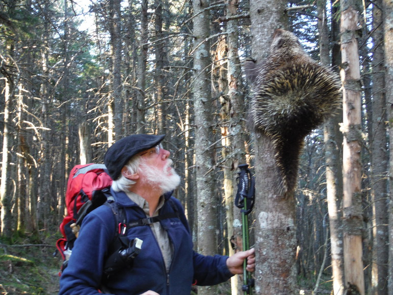
We hiked out of the lower elevations and the woods changed from the maple and oak hardwoods that Vermont is famous for into the thick jack pine of the high ski country. We came upon a porky pine, which the locals in Vermont call a prickle. They are slow moving so I chased him up a tree so I could pose for a picture that I'll try to post with this story. I have been pasting pictures on facebook all along to try to generate interest in the Appalachian Trail and for my readers that cannot hike. I hope folks don't find me too vain.
Some pessimist once said what goes up must also go down. In our case, it is always true and we started our descent on the mountain. We had a new incentive today because at the road is a state park with a pay shower.
We ended the day early at the state park. I had a long conversation with the ranger and he offered to let us stay in a special campsite reserved for hikers, but we were only interested in the shower. We went to our showers that cost two quarters for the first five minutes to start the shower, then a quarter for each 3 minutes after that. The water was only piss warm, but it felt so good to get the trail dust off after several days. I stayed in for about $48 worth of shower.
We had to
I'm done writing for now, but, I will continue to blog on this page when I have something to say...
To purchase
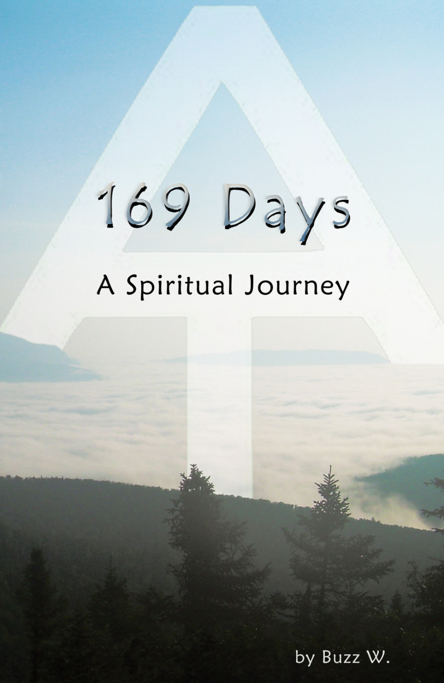
169 Days A spiritual Journey:
click on contact page.